Hi all. This is Tracy, with a detailed debrief from Day One (and a short update from Day Two as well). Jim, Eddie, and I got on the road to Yosemite Wednesday morning at 6 a.m., after a visit to the new Starbucks in Oakhurst for the guys’ last good cup of coffee for the rest of the month. With freshly minted Happy Isles permit in hand, we wended our way into the park to the actual “no-asterisk” start of the John Muir Trail (elevation 4,040′), found a parking lot that was about a half-mile from the trailhead, and were packed up and on the trail by 8:00 a.m. Well, the guys were packed up, that is—to the tune of about 45 pounds apiece—I had a water bottle. Note the mileage to Mt. Whitney:
The morning was pretty cold, which was a nice way to start, although I’m not sure Eddie would attest to the chill’s being a fair counterbalance to the insulting barrage of steep stone steps and 1,000 feet of climbing in the first mile. We took the Mist Trail to Vernal Falls, which usually means a good soaking on the way up the steps, so the guys stopped at the first bridge to put on their pack covers. This led to lots of rummaging around and poles flying, followed by a nearly complete unpacking of Eddie’s backpack and a discovery of items he did not know he was carrying, such as a giant syringe (part of a snake bite kit?), a bale of nylon twine (two different gauges), and some gaiters that were way too big for his skinny legs. (I now have these items in my possession in San Francisco, and have had a few offers for the syringe.) As it turned out, the pack covers were unnecessary since the falls were not falling very hard, but it was a worthwhile exercise since it relieved Eddie of some pack weight.
We continued to climb—first to Vernal Falls,
and then up and over the south slope of Mt. Broderick (~6,700’) and Liberty Cap (~7,100) on the trail to Nevada Falls (~6,000′).
As you can see, it was a bit unrelenting on the way up, but it was really beautiful.
(These photos are from my iPhone and don’t quite do justice to the scenery, but Jim already has lots of great pictures on his camera, and he will post a link to them when he gets back, after which the man-of-leisure will commence to making what is sure to be a studio-quality video production.)
OK, so remember that sign on the valley floor at the start of the trail that said it was 211 miles to Mt. Whitney? Well, here is the sign at the top of Nevada Falls (yes, we were going the right way):
On a side note, this was also the first point at which Eddie’s SPOT actually sent out a signal, even though he had set it to transmit as soon as we started the hike, so do not worry if you don’t receive regular check-ins from SPOT. There is sporadic cell-phone coverage at certain points along the trail, so I will post updates as I get them.
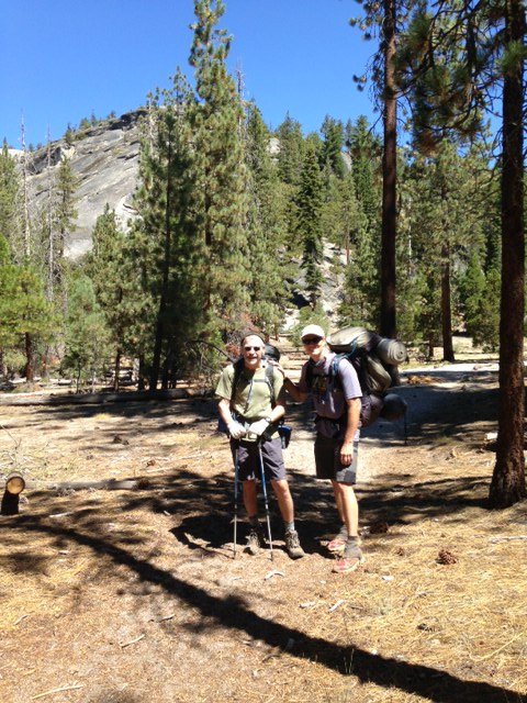
By the time we got to the top of the Nevada Falls, it was pretty hot out, but the trail eased up for the next mile or so as we headed towards Little Yosemite Valley (my turnaround point)–it was sandy and relatively flat, and there were lots of trees and good shade. We took a break there, and Jim MacGyvered my jacket into a backpack, and we loaded up the trash (i.e., Honey Stinger and PR Bar wrappers) along with Eddie’s badminton set and snowshoes, and I turned around to head back down. Their farewell photo is below. Jim and Eddie would then head over that hill behind them and to the right (northeast towards Tuolumne Meadows), and were planning to make their way to Sunrise High Sierra Camp to spend the night.
I turned around here and took the longer route down from Nevada Falls to avoid all of those steps, and as I got to Vernal Falls, with the heat blasting and the tourists streaming in, I found myself wishing I were still up there hiking in the other direction with Jim and Eddie. I made it down pretty quickly, though, so I was in the van and on the park-road by 1:45 p.m. Jim called at about 5:15 to say that Eddie was pretty drained after the long climb, compounded by the altitude and almost no sleep the night before, so they had decided to end the day early and set up camp (maybe at Sunrise Lake?), and then would try for an early start to make up some ground the next morning. In the meantime, I arrived at Eddie’s place in Walnut Creek before 6 pm, dropped off the green monster, showered, re-packed, and headed into the city. Day One was pretty successful all around.
JMT DAY TWO—AUGUST 15, 2013
I spoke with Jim late this afternoon. Eddie had made a great recovery from what sounded as though it was a pretty awful first night at altitude, featuring everyone’s favorite affliction: nausea and vomiting. Jim said everything started to get better after they ate some “real” food for dinner and then again for breakfast. Then, before they hit the trail this morning, Jim transferred some of the heavier gear out of Eddie’s pack (including his bear canister and tent). They were able to start up again at a decent pace, but decided not to push too hard, so they made it a short day and set up camp when they got to Tuolumne Meadows. They are a day behind schedule but have a long time to catch up, and both Jim and Eddie seem to be in good spirits–further buoyed by soft-serve ice cream from the store near the campsite–I could hear Eddie cracking up in the background. Nice recovery and good outlook on Day Two.


