Leadville 100

On Wednesday of this week I flew to Leadville in advance of Saturday’s Leadville 100 Trail Race..  I wasn’t running this event, but I was pacing my friend Mike in it.

On Thursday, I was at the Mt Elbert trailhead by 5:30am and was on the summit of Mt Massive by 9:00am.  The wind was intense and I almost turned back since I had every piece of clothing I brought on and I was still freezing (see pic below).  I ran the 6 miles back to the car, refilled my water and set out up Mt Elbert.  My heart wasn’t in it and I didn’t want to face the wind again so I turned around at tree line.  I still got 20 miles and 7,000 ft of climbing in.

Image0 (2)

Friday was spent mainly on calls for work, but I did get to go to the runners briefing.  While most of the briefing consisted of corporate babble from the sponsors, there were some inspiring spots from the many multi-year finishers of the race.  On Saturday at 4am, Mike V set off.  I first saw him at mile 24 and he looked good and most importantly, was right on his goal card.  The Leadville race has a 30 hour cut off so it was a tough one for Mike to choose to be his first 100.   Mike also came in at 40 miles to the minute on his card.  The picture below is from this point which is followed by going over a 3,500 ft pass and then turning around and coming back.

IMG_2113

When Mike got back, he had blown his goal times, and was only 2 minutes off the cut off time – which means that if he had come in 2 minutes later, they would have pulled him from the race.  He was cranky, he had let his nutrition go, and gave us the speech that all hundred milers have given on how there is no way he can run 40 more miles.  Since I was the next pacer, my response was that is great because we are going to walk the next 15.  Over the next 5 hours, Mike slowly got calories into his system while putting one foot in front of the other.  Most importantly he realized that he could do more than he thought he could do.  The pic below is Mike climbing a hill about mile 65 – head down, small steps, good posture, and moving forward…

IMG_2115

I turned him over to Jamie at mile 75.  Jamie kept the pace up and turned him over to Dave for the home stretch at mile 86.  Mike promised me he’d run the finish so I don’t feel bad about showing the world how I reminded him.  In the end, Mike V is now the owner of a Leadville belt buckle and we are all very proud of him.  This afternoon he spoke about being one and done, but my guess is he’s looking for his next race within 2 weeks.

North Lake to South Lake

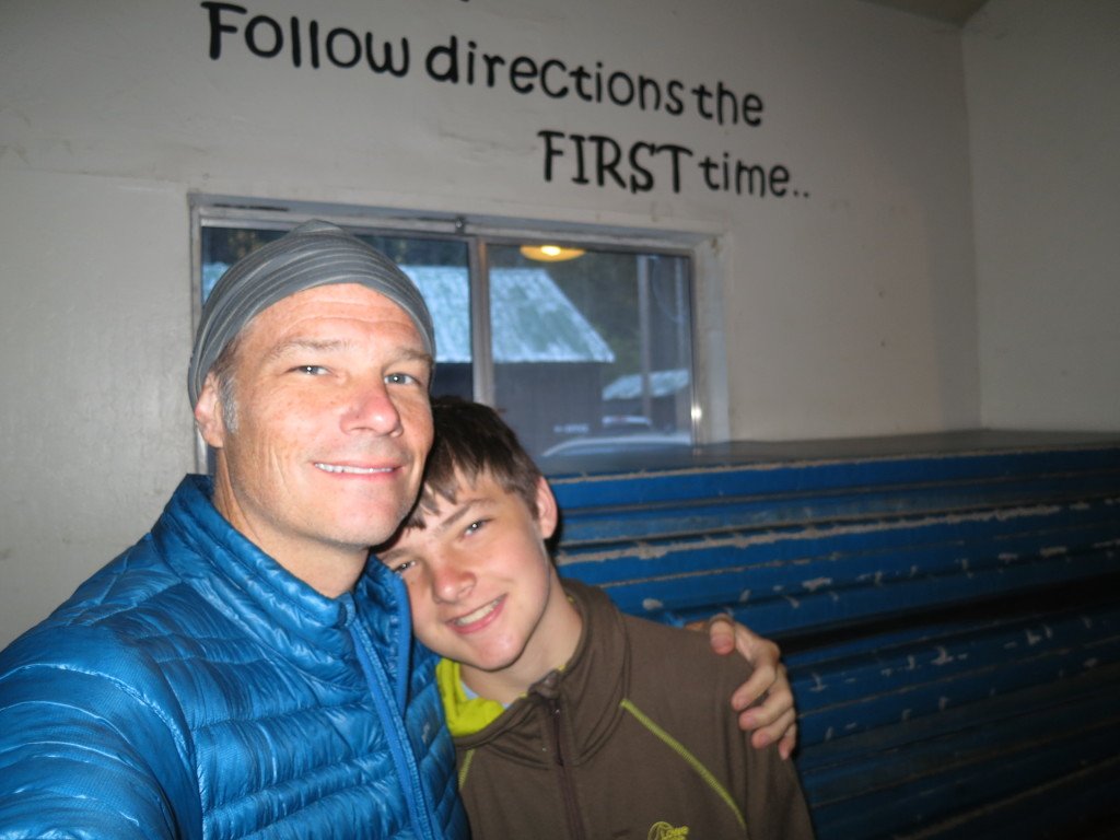
Last week, 6 friends joined Preston and me for a ~60 mile backpacking trip into the Sierra Nevada’s.  The group consisted of 3 dads and 5 kids ranging in age from 14 to 17.  On Saturday, we flew to LA and the group met in Independence, CA at the Mt. Williamson Motel for our last night of sleep in a bed.

IMG_1861

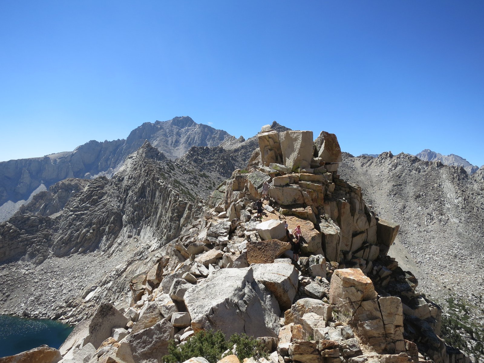
The following morning, the weather was beautiful and we left for a training hike up Kearsarge Pass around 8am.  The trail to the pass climbs about 3,000 feet over 5 miles to an elevation of just under 12,000 ft.  The purpose was to get everyone used to the terrain without backpacks and to help with the acclimatization to the altitude.  At the pass, there is a rock pinnacle that the crew couldn’t help but climb.

IMG_1862

IMG_1874

IMG_1881

IMG_1892

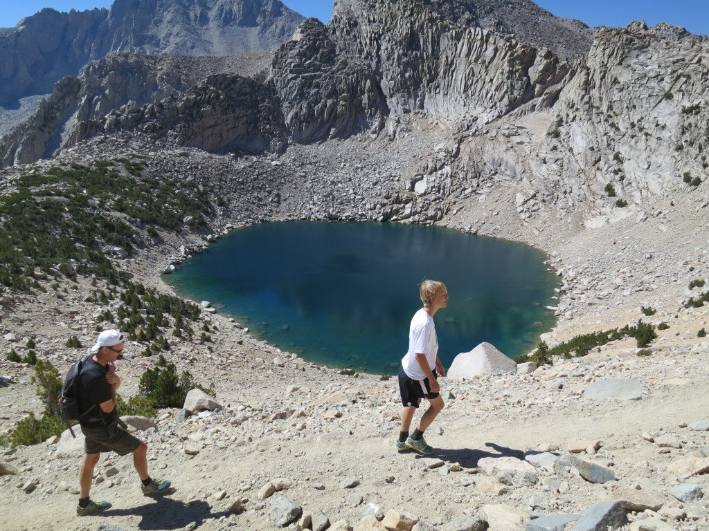
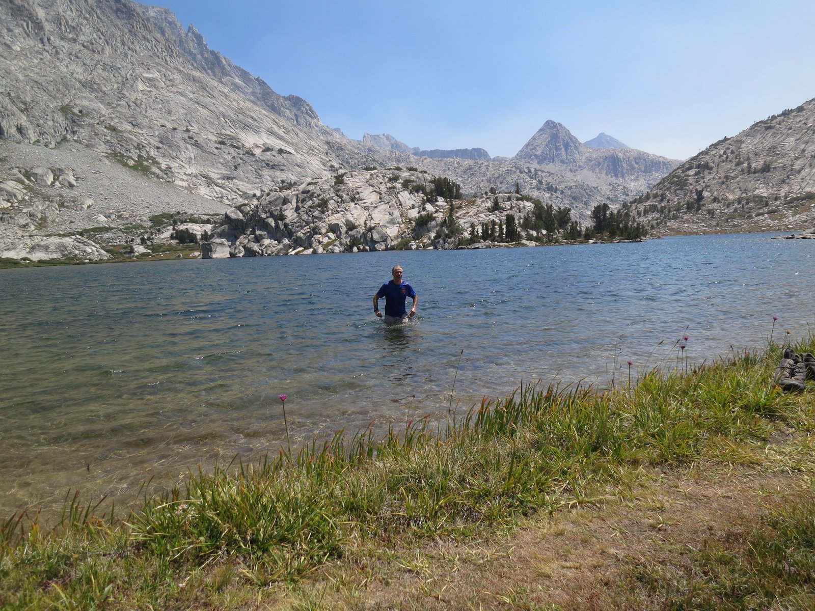
On the way down, we passed several lakes and Maddie had to test the waters.

IMG_1893

We then drove an hour north to Bishop and after lunch, we headed to the North Lake Trailhead.  The Trailhead leads to Piute Pass and then into the Humphries Basin and eventually to Piute Canyon.  We found a suitable campsite near the trailhead and staged the cars for our return to South Lake.  The following morning we set off through the forest and switchbacks to the pass.

IMG_1904

IMG_1901

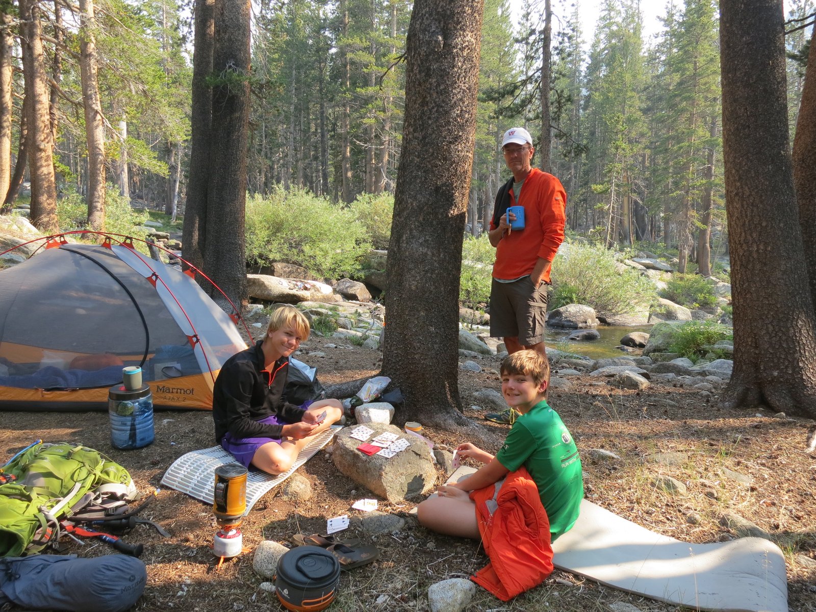
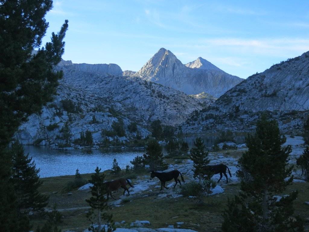
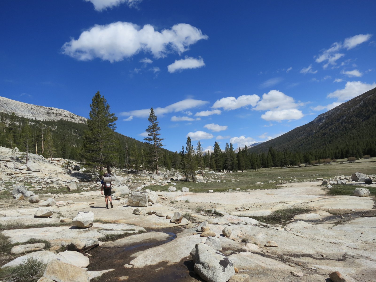
Once crossing over the pass, we descended into the massive Humphreys Basin.  The Basin looks like a vast wasteland of rock and wind.  It is bordered by 13,000 ft peaks to the North and South.  We proceeded west to Hutchinson meadow where we found a great campsite next to Piute stream.   After a swim and many games of cards between Preston and Henry, we bedded down for the night.

IMG_1907

IMG_1911

IMG_1915

The next morning we crossed the meadow and headed down the magnificent Piute Canyon.  The narrow trail winds down the west side of the canyon.  The views are stunning and in places, the creek is several hundred feet below a sheer drop off.   The canyon ends at the John Muir Trail and the entrance to Kings Canyon National Park.  We turned East and followed the river to our next campsite near the entrance to Evolution Basin. At camp, more cards were played and Jack assumed his signature sitting pose of entitlement.

IMG_1920

IMG_1924

IMG_1926

IMG_1930

IMG_1934

IMG_1936

The next morning we started the 2,200 ft climb to Evolution Lake.  The climb required 11 miles of switchbacks and a water crossing but we moved quickly and reached the campsite by 1pm.

IMG_1941

IMG_1940

IMG_1945

The sun was hot and the water was cold, but everyone in the group jumped in.  Later in the afternoon, smoke from a distant forest fire blew in and bought a lot of haze.  The lake is positioned in what is known as a hanging valley.  These valleys were formed when the glaciers retreated leaving small pieces to continue to erode pockets in the canyons.  The result is basically basins that step up as you near passes.  This creates sheer drop-offs on the edge of the valleys.  With the addition of the haze to sunset, some spectacular colors in the sky are created from the valley overlook.

IMG_1958

IMG_1959

IMG_1960

IMG_1969

IMG_1970

IMG_1971

IMG_1974

The next day was going to be challenging, so we left early.  Our plan was to climb out of Evolution Valley to Muir Pass.  The climb was only 1,200 ft, but it’s through some very rough trails to just under 12,000 ft.  On top of the pass, sits the Muir hut which was built by the Sierra Club in the 1930’s.

IMG_1989

IMG_1983

IMG_2021

IMG_2011

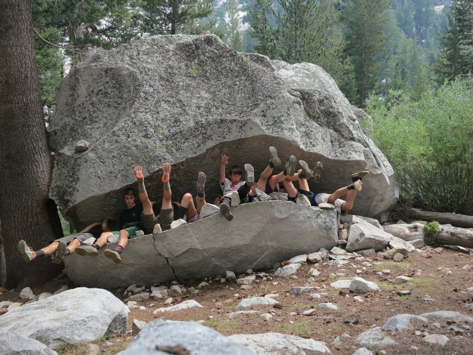
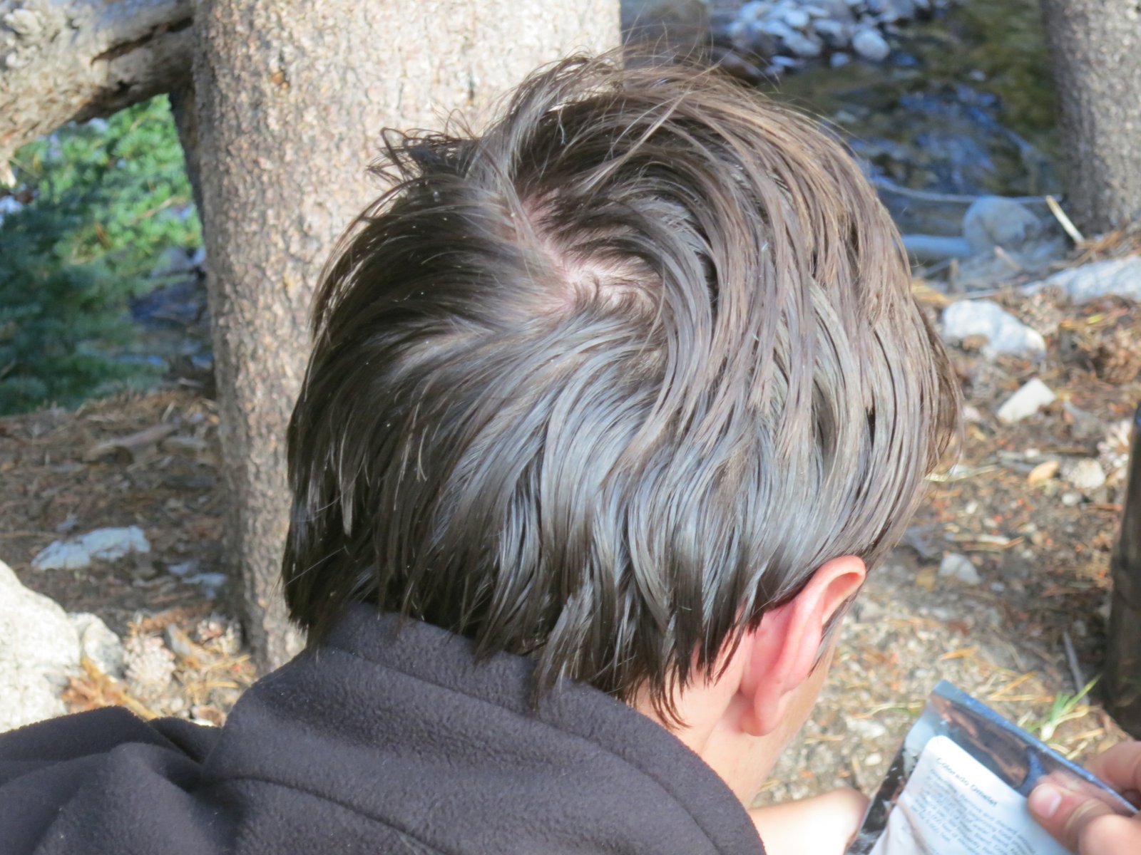
After the hut, the trail descends sharply into Le Conte Canyon.  This is one of the more challenging parts of the trip since we had to drop nearly 3,000 ft in the heat and dust.  The grade of the trail wore on everyone’s legs and they were very happy for a short break in the mouth of the John Muir Trail Monster.  Everyone seemed to have fun with it, except Jack; as you can see by his refusal to lie down and the scowl on his face.  Once at camp, many soaked in the creek to clean-up, and a few others (like JT) needed a good hair scrubbing to remove the grease.

IMG_2032

IMG_2036

IMG_2038

IMG_2044

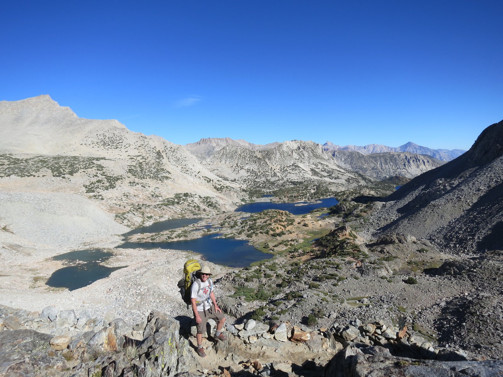
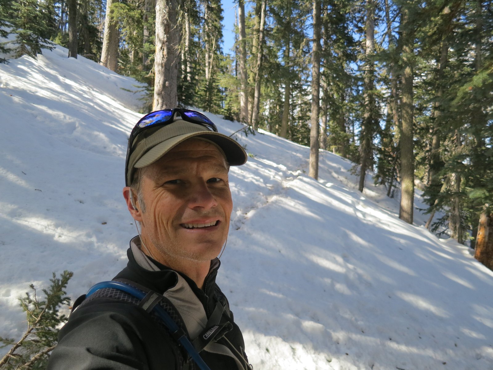
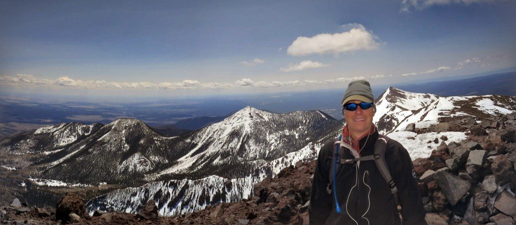
The next morning, we had our biggest climb of the trip – over 2,400 ft in 7 miles.  The senior member of the crew (Brad) took care to loosen up his muscles before setting out.  The climb consisted of leaving the JMT and turning north towards Bishop Pass.  Along the way the views were spectacular and our campsite in Dusy Basin was even better.  While the smoke was much less than it had been in previous days, the small bit that came in created some spectacular colors at sunset.  Through the day, the only thing the kids talked about was all the different types of food they were going to eat the following day.  There were requests to get up before dawn and hit brunch (from Jack of course).

IMG_2050

IMG_2054

IMG_2075

IMG_2083

The morning of the last day was another beautiful day.  The sunrise in Dusy Basin was incredible.   It was just a short climb to Bishop Pass and then 6 miles of downhill switchbacks to the South Lake parking lot.   Grant and I went ahead so we could drive back to North Lake and pick up the car we left there.  Everyone made great time and soon we were back in Bishop for lunch.

IMG_2090

IMG_2097

IMG_2106

IMG_2110

The trip was fantastic; really appreciate Grant, Brad, and their families for sharing the time with us.  While my watch lost it’s way a few times, it said we did over 58 miles and close to 14,000 feet of climbing.

Front window leak

Update since the window is not fixed yet – Oct 30, 2015

A big storm hit us this morning with winds from the Southeast…  the leak was worse than we’ve ever seen it.

window_leaking_2015_11_2

window_leaking_2015_11_1

Thought this would make it easier for Roofcrafters to have all the history on the window leak we have in the new window.  The leak is in the dinning room window coming from above.  Not sure if the leak is in that window or the window above (it was replaced also) and the water is leaking through the wall.  The leak only happens when the storm comes from the east and the window pushes the rain against the window.

leaking_window

The window has always leaked since installation- the photo below is from June 25, 2014.  My description sent in an email: One big one that just popped up is the dining room window is leaking a river… I’m not talking about a drop here or there, it’s basically a faucet on low. I think it needs some major rework, a little patch isn’t going to do it.  Here is a picture of it when the rain came through this morning. Water is pouring in right of the blinds brace

window_leak

Troy came out that same day and did some chaulking, didn’t solve the problem.  Description sent back on June 26, 2014: Thanks for coming out yesterday… while the caulk slowed the water flow, the towel on the inside is soaked after the rain last night. Can you please come back out and see if you can figure it out. 

Troy came the following day – unsure what he did but the rain ended for the summer so hard to tell if it was fixed.

Nov 22, 2014 – Email:  I’m sure I’m the last person you want to hear from, but the leak that Troy worked on is still flowing. I took a video of the leak to help you pinpoint where it’s coming in front.  During one of the cloudbursts today, I got 1/2 gallon of water in an hour.
I checked the window above it since Troy thought it might be seeping down, but there wasn’t much water build up on the sill.

I went on vacation, but Al came out the week we were gone:  Yes Al did make it out last week and he did silicone some areas around your window, this is probably what you are seeing.  I assume what you are seeing is on the outside, correct?  Please keep your eye on this area and if there is further leaking let us know right away so we can further evaluate.  

All spring, the window held fine.  I’m assuming it was because most of the storms came from the south or west.  Once we got the rotation coming off the gulf this weekend, the weather came from the east and the window leaked again.  Although, not the volume it did before.  I’m unsure if it’s because the storm was short lived or the leak has been partially patched.

June 21, 2015

Window_leak_2015_2

Window_leak_2015_1

Stray dog

Tracy left the house for an appointment on Sunday afternoon but she walked back in 5 minutes later with this little guy in her arms.  While she was gone, I babysat him with our dogs and they were all fast friends.  I posted a video below of them playing.  Izzy was really nice even though his puppy energy tested her patience.

When Tracy returned, we took him to the shelter to see if he had been chipped.  He had, but his owner had essentially abandoned him to the streets.  Tracy talked to him on the phone and he didn’t want the dog anymore – what a nice guy.  We took the dog to the main shelter to find out that he’d been adopted twice previously.  Since he’s a puppy and really sweet, he will get adopted quickly for the third time.  The shelter had named him Ranger.

IMG_1856

Shadow of the giants 2015

On Saturday, the 26th running of the Shadow of the Giants 50k was held in Fish Camp, CA.  It was the 4th time I had run the race.  Preston has run the 20k twice, but didn’t want to run this year so he hung around the start line and read his book for the morning.

IMG_1850

The weather and course were beautiful for the eighty two 50k runners that started.  My official time was 4 minutes faster than the previous year which put me in the faster half of the runners.

IMG_1851

Yosemite Backpacking

For the last few days, Preston and I hiked in Yosemite,  We hiked up Rafferty Creek to the area around the High Sierra Camp.

IMG_1792

The trail climbed about 1,500 feet over 5 miles so we took it slow since we weren’t acclimated to 88600 ft yet.

IMG_1798

When we hit the pass, the mosquitos were out so we looked for a place to camp so we could get shelter from the bugs.  We decided on Booth Lake but we stayed away from the water and camped on the tarns about 100 feet above the lake.  It was better, but the mosquitos were still bad.

IMG_1805

Our camp was on a rock shelf that still had snow fall and a very daring Marmot.  He reminded me of our dog Izzy since no matter how much noise we made, he kept coming closer to check out our gear for food.  Preston wanted to test the snow and found that the warm temperature had melted it enough to cause him to “post hole” in sandals.

IMG_1813

IMG_1815

We went to bed early that night but woke up with sunrise before 6am.  Since the next day only required us to go about 3 miles, we decided to climb the peak across from the lake.  The unnamed peak looked to be about a 1500ft climb with a reasonable approach.  We set off up the trail so we could get around the lake before going cross country.  The cross country route required a little creek hopping, but we finally reached the slope on the other side and started a switchback route up the face.  Once we hit the halfway point we found a crease that a creek created and we followed it.  At one point, it was choked with boulders that required we to go around, but Preston was determined to find a route through it.  The pictures below are of him entering and exiting the pile of rocks.

IMG_1818

IMG_1832

Once we got to the saddle, we saw that the ridge was sheer on the opposite side and the side we were on had huge boulders that made the climb pretty risky,  We decided to call that our summit at 11,100ft.  In the background of the picture below, you can see how steep the opposite side of the mountain was.

IMG_1825

When we got back to camp the bugs were coming out so we packed up and started climbing to our next camp site,  The trail had a lot of snow on it that was slowly melting turning the rest of the trail to mud.  We climbed about 700ft and crossed into the Evelyn Lake basin which was where we were spending the next night.   At this altitude, there were no bugs, but it was cold and very windy.  The lake was still half covered with ice and there was very little cover.  We found a spot in a few trees that helped a little, but we settled into the tent to play cards for the rest of the day.

IMG_1840

The next morning, we started down the trail.  Our destination was about 7 miles away at a much lower elevation.

IMG_1845

On the way we determined that if we felt good enough, we’d go 4 miles further back to the car and see if we could sleep warm and bug free the 3rd night.  Preston set a serious pace and we did the 11 miles in less that 4 hours,  We stayed in a hotel in Oakhurst last night and watched the first game of the NBA finals.  Tomorrow, I’m running the shadow of the giants 50k again.  The weather looks like it’s going to be perfect.  All the pics are below.

IMG_1791.JPG IMG_1792.JPG IMG_1793.JPG IMG_1796.JPG IMG_1797.JPG IMG_1798.JPG IMG_1815.JPG IMG_1799.JPG IMG_1800.JPG IMG_1801.JPG IMG_1802.JPG IMG_1803.JPG IMG_1805.JPG IMG_1806.JPG IMG_1807.JPG IMG_1810.JPG IMG_1812.JPG IMG_1813.JPG IMG_1817.JPG IMG_1818.JPG IMG_1822.JPG IMG_1823.JPG IMG_1824.JPG IMG_1825.JPG IMG_1830.JPG IMG_1831.JPG IMG_1832.JPG IMG_1834.JPG IMG_1835.JPG IMG_1837.JPG IMG_1838.JPG IMG_1840.JPG IMG_1841.JPG IMG_1842.JPG IMG_1845.JPG IMG_1846.JPG IMG_1848.JPG

May in Leadville

This weekend I went to Leadville to look for houses.  I flew to Denver on Friday night and stayed  close to the airport.  Early Saturday morning, I drove to Leadville and went straight to the Mt Elbert trailhead.  I wasn’t meeting the realtor until 3:30pm so I thought I’d see how high I could get before the snow was too unwieldy.  When my steps post holing got too much to bear, I was at the first meadow right before tree line.  I sat down on a log and ate lunch.

IMG_1761

The views  of the far range and Mt Massive to my north (picture below) were incredible.  The sun was shinning and the birds were very interested in my sandwich.  I managed to coax them in closer and closer until one would take the bread right out of my hands.  I was a little late clicking the button on the picture below, but you can see the bird flying away with a mouth full.

IMG_1775

IMG_1778

I only went 5 miles, but it took me over 3 hours to get through the sloppy snow.  I made it back in time to take a shower before looking at 10 houses with the agent.  I decided on one and put an offer in.  We’ll see if they will take it.

On Sunday, I met a friend’s brother, Mark, who drove in from Denver.  He has the trail running bug and we decided to try our luck on the trail leading to Mt. Massive.  The one mile of switchbacks to get us back on the main part of the Colorado trail was relatively clear, but once we turned north, the snow was deep and we slowly made our way through it.  After a quarter mile or so, we decided to turn back and try going the other direction on the Colorado trail past the Mt Elbert trail turn off.

IMG_1779

After running back down the hill, getting slightly lost, we climbed the switchbacks out of the other side of the valley.  Once on top, the trail was clear all the way to the turn off.  However, not more than a half of mile after, the snow was deep again.  We adjusted and decided to climb to the same point on Elbert I did the day before.  It took us over an hour, but I was again on the same log that I ate lunch on the day before.  Same great views, but more wind and no birds.  We decided to take a timed shot, but the camera fell before the picture was taken.  The resulting picture turned out pretty cool.  The following picture is the one we were hoping for.

IMG_1781

IMG_1782

We headed back down and ran across a furry friend on the trail

IMG_1783

Once down, we didn’t feel we had enough so we ran the forest road for a few more miles.  My sea level lungs had to walk the hills, but Mark ran the whole thing.  In total, we did a little over 13 miles and climbed about 3,000ft.  All the pictures from the weekend are below.

IMG_1756.JPG IMG_1760.JPG IMG_1761.JPG IMG_1762.JPG IMG_1764.JPG IMG_1771.JPG IMG_1774.JPG IMG_1775.JPG IMG_1778.JPG IMG_1779.JPG IMG_1780.JPG IMG_1781.JPG IMG_1782.JPG IMG_1783.JPG IMG_1784.JPG IMG_1785.JPG IMG_1788.JPG


Arizona Trip

This last week, I had a business trip to my undergraduate school, NAU.  On the way there, I met with my old friend  David for a hike in Sedona.  Unfortunately, the night before I got really sick so the hike was a haze and after taking the wrong trail, I had to bow out and head to Flagstaff.  The pictures below are from our start at Midgley Bridge into Wilson Canyon.  Our trail choice was poor so when it ended we started to go cross country and ended up climbing a slot canyon that ultimately got too sketchy so we had to turn around.

IMG_1740

IMG_1741

I went to Flagstaff later that afternoon and feel asleep at 4pm and didn’t wake up for 12 hours.  The next morning, I was on the road at sunrise and went to Snowbowl to do a very early season summit of Humphreys Peak.  The hike was fine until about 11,000 feet and then the snow became very deep and the trail disappeared.  I had to climb almost vertically to the saddle for close to 1,000 feet.  Once on the saddle it was pretty easy going except for the 30mph wind.

IMG_1743

It’s been many years since I was on the summit this early in the year.  A normal 1:45 trip took 3 hours, but I was happy to make it.  All the pictures are in the album below.

IMG_1748-PANO

Response code is 404


Racing and a Storm

Tracy is rowing on one of the Austin crew teams.  This last weekend she had several races in which her team placed 2nd in each.  While her rowing schedule is a huge commitment, you can see the effect on her body in the picture below (she’s the gun show on the left).

Tracy_rowing

Here’s a little video of the race

The following evening we had a crazy storm roll through Austin.  We had hail the size of grapes and a lot of it.  The aftermath is pictured below.

IMG_1737

IMG_1736